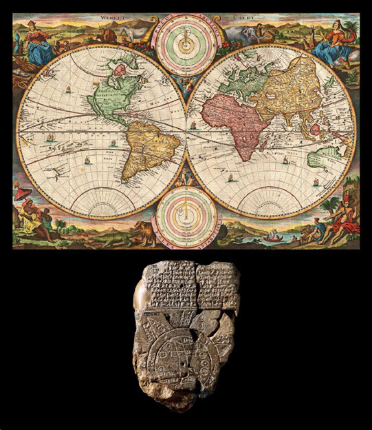
The journey of mapmaking, an essential aspect of human history, began with the curiosity to explore and understand our surroundings. As early settlements and civilizations flourished, necessitating trade and communication, the creation of maps became increasingly vital. Early maps, dating back over 4,500 years, focused on local and regional purposes, including city planning and marking trade routes.
The Babylonians, around 600 BCE, undertook the ambitious task of creating a map of the known world. Their circular representation, with lands surrounded by water, signifies one of the earliest global mapping attempts. However, it also illustrates the subjective nature of early cartography, often reflecting the perspectives and biases of its creators.
The concept of a spherical world map gained traction with the insights of Greek scholars like Pythagoras and Eratosthenes. Around 500 BCE, Pythagoras proposed the idea of Earth’s spherical nature, which Eratosthenes, about 250 years later, substantiated with his groundbreaking calculation of Earth’s circumference, laying the foundation for modern geography.
Subsequent centuries witnessed the contributions of explorers, traders, and conquerors in mapping the world’s terrains, shorelines, and geographic features. By the late eighteenth century, a more accurate representation of the world’s lands and seas was established.
Today, with the advent of satellite technology, mapping has reached unprecedented levels of precision and detail. This technological leap allows us to monitor and document even the minutest natural and anthropogenic changes on our planet, underscoring the dynamic and ever-evolving nature of mapmaking.

