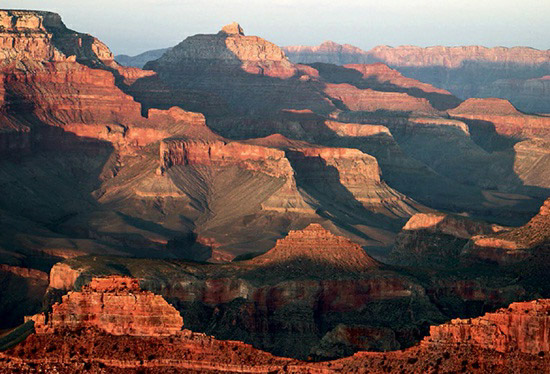
The Grand Canyon, one of Earth’s most remarkable geological formations, showcases the powerful erosive force of liquid water over time. It is a prime example of how rivers and streams can shape even the toughest continental bedrock into deep canyons, particularly when the rock is in a state of uplift, making it more vulnerable to fluvial erosion.
Spanning just under 300 miles (480 kilometers) and reaching widths of up to 20 miles (32 kilometers), the Grand Canyon primarily runs through Arizona but also touches parts of Nevada, Utah, Colorado, and Wyoming. Its depth plunges nearly 6,100 feet (1,860 meters) from the rim to the riverbed, revealing a vast array of colorful sedimentary, volcanic, and metamorphic rocks. This natural wonder exposes nearly 2 billion years of Earth’s geological history.
Geologists debate the precise timeline of the Grand Canyon’s formation. While parts of the Canyon may have begun forming during the late Cretaceous period (70–65 million years ago), as part of the uplift that created the Rocky Mountains and the Colorado Plateau, most agree that its current form is much younger. The convergence of older canyon networks with newer, deeper ones formed by erosion likely occurred around 5 or 6 million years ago, suggesting the Grand Canyon, in its present state, is relatively young.
The Grand Canyon has been home to human communities for thousands of years, with its river, vegetation, and wildlife providing essential resources for survival in the surrounding desert environment. Today, it serves as a vital resource for hydroelectric power generation, tourism, and ecological and geological research. Its majestic beauty and immense scale make it not only a national treasure but also a testament to the enduring forces shaping our planet.

