The Hawaiian Islands are an exemplary illustration of Earth’s internal heat release through mantle convection and the concept of hotspots. Unlike common volcanic activities along tectonic plate boundaries, hotspots are unique areas where volcanoes erupt in seemingly random locations, far from plate edges. Notable examples include the Deccan Traps, the Yellowstone Caldera, Iceland, and, most famously, the Hawaiian Islands.
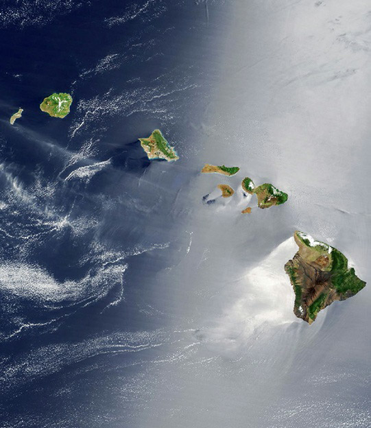
The Hawaiian archipelago is comprised of two segments: a 1,500-mile (2,400-kilometer) chain of islands and seamounts stretching northwest from the Big Island, and a 1,000-mile (1,600-kilometer) chain of seamounts extending north-south towards the Aleutian Islands. The linear arrangement and a sharp bend in the alignment provided crucial clues about their formation.
Canadian geologist John Tuzo Wilson, in 1963, was key in deciphering the formation of the Hawaiian chain through his hotspot hypothesis. This theory was supported by the varying ages of the volcanic rocks across the islands. The Big Island, currently experiencing volcanic activity from Kilauea and Mauna Loa, is the youngest. Moving northwest, the islands get progressively older, with Maui’s rocks being about one million years old, and those on Molokai, Oahu, and Kauai being 2, 3, and 5 million years old, respectively. The oldest exposed island, Kure atoll, is approximately 28 million years old.
This age progression indicates that the Pacific plate has been slowly moving northwest over a relatively stationary hotspot. As the plate moves, new islands are formed over the hotspot, while the older ones are carried away with the plate’s motion. The Hawaiian Islands thus represent a dynamic geological process, showcasing the interaction between deep Earth forces and surface geological features.