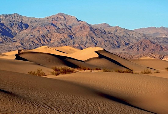
Death Valley, located in the Southwest of the United States, exemplifies the dramatic effects of tectonic activities. The subterranean remnants of the Farallon plate have given rise to buoyant magma that exerts upward pressure on the North American plate, resulting in the formation of deep valleys called graben, flanked by high ridges or horst. This geological phenomenon characterizes the Basin and Range region, which stretches from northern Nevada through northwest Mexico.
Within this region, Death Valley stands out as the deepest graben. Spanning 140 miles (225 kilometers) in length and 5 to 15 miles (8–24 kilometers) in width, it lies just west of Las Vegas. This valley has sunk to the point of being the lowest elevation in North America, nearly 300 feet (90 meters) below sea level. Despite being filled with sediments from surrounding mountains, its extensive history of water bodies, evidenced by large salt and borax deposits, has faded due to ongoing regional uplift and climatic shifts.
The current landscape of Death Valley is a stark display of rocky sediments and vibrant mineral deposits, shaped by erosion from the surrounding arid mountains onto a vast, flat valley floor. The region’s dryness is exacerbated by neighboring mountain ranges that trap water vapor, contributing to its status as one of the world’s driest areas, with an average annual rainfall of about 2 inches (50 millimeters). Furthermore, Death Valley holds the record for the highest reliably recorded air temperature on Earth’s surface at 134°F (57°C), cementing its reputation as a place of extreme environmental conditions.