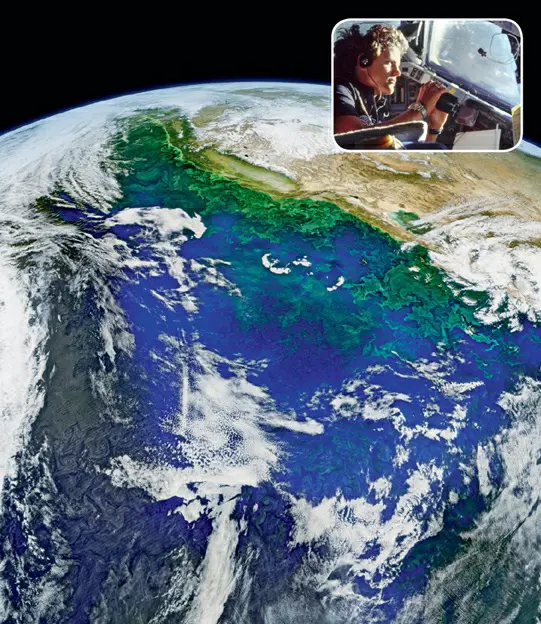
Oceanography, the scientific study of the Earth’s oceans, has been revolutionized by the advent of space-based remote sensing. This transformation began with the 1978 launch of NASA’s Seasat mission, the first satellite dedicated to oceanic studies. Despite its brief operational period of only 106 days, Seasat proved invaluable in measuring various oceanic parameters such as sea-surface winds, temperatures, wave heights, internal waves, and sea ice features.
Building on Seasat’s success, space shuttles in the 1980s carried out astronaut-tended oceanographic observations. Notably, oceanographer and astronaut Kathryn D. Sullivan, a key figure in these efforts, flew on three shuttle missions and contributed significantly to earth science research from space. Sullivan’s involvement in oceanographic expeditions for her doctoral research, coupled with her later role as Administrator of NOAA, solidified her impact on advancing oceanography from space.
A significant leap in space-based oceanography was marked by the 1993 launch of the TOPEX/Poseidon mission, a collaboration between NASA and the French Space Agency. Operating until 2006, this mission provided unprecedented continuous global coverage of ocean surface topography, unveiling critical patterns of ocean circulation that are integral to understanding Earth’s climate.
Subsequent missions, such as the Jason series and continuous observations from the International Space Station, have furthered our understanding of the oceans. These advances in oceanography from space underscore the oceans’ crucial role in Earth’s climate system and demonstrate the power of satellite technology in enhancing our understanding of the planet.

