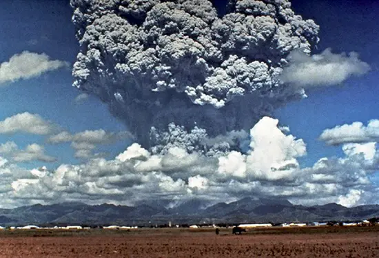
The 1991 eruption of Mount Pinatubo, located in the densely populated region where the Pacific and Eurasian plates collide, stands as a significant geological event with far-reaching impacts. This Philippine stratovolcano had been dormant for over 500 years, leading to the development of lush rainforests and urban settlements around its base. However, the tranquility was disrupted when seismic activities indicated an impending eruption.
Thanks to the vigilant monitoring by the Philippine government and agencies like the US Geological Survey, a massive evacuation plan was implemented in the spring of 1991. Over 60,000 people within a 20-mile radius of Pinatubo’s summit were relocated, a decision that proved crucial in the days to follow.
On June 15, 1991, Mount Pinatubo erupted, ejecting an immense plume of ash, dust, and gases into the stratosphere. Coinciding with a tropical typhoon, the eruption triggered landslides and lahar mudflows, causing widespread destruction. Despite the chaos, the proactive evacuation efforts remarkably minimized the human toll, with under 1,000 fatalities, a number significantly lower than what might have been without such measures.
The eruption’s aftermath saw global climatic effects, with the ejected particles causing stunning sunsets worldwide and a notable decrease in average surface temperature. Rated a 6 on the Volcanic Explosivity Index, Pinatubo’s eruption was a pivotal moment in understanding how volcanoes can influence Earth’s climate.
This event underscored the critical role of geological monitoring and prediction in safeguarding communities against natural disasters, turning Mount Pinatubo into a case study for volcanic eruption management and disaster preparedness.

