Marie Tharp’s contributions, alongside Bruce Heezen, revolutionized our understanding of the seafloor, an area covering over 70 percent of Earth’s surface yet shrouded in mystery for most of human history. The advancement of sonar technology, initially used in World War I for military purposes and later for civilian oceanographic research, paved the way for detailed mapping of the ocean’s topography.
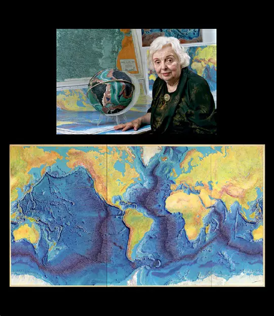
Working at Columbia University in the late 1940s, Tharp, an American oceanographer, alongside American geologist Bruce Heezen, played a pivotal role in interpreting bathymetry data collected through advanced sonar equipment. Tharp’s work, particularly in mapping the mid-Atlantic ridge, provided groundbreaking evidence supporting the continental drift hypothesis. Despite initial skepticism, Tharp and Heezen’s comprehensive map of the North Atlantic seafloor’s physiography, published in 1957, convinced many in the scientific community.
Tharp’s seafloor maps were instrumental in the development of plate tectonics theory. Her identification of the mid-Atlantic ridge as the largest continuous mountain range on Earth was a significant discovery. Today’s advanced sonar technology, combined with specialized expeditions, continues to enhance our knowledge of the dynamic seafloor, revealing features like underwater mountains, trenches, volcanoes, and evidence of seismic activity.