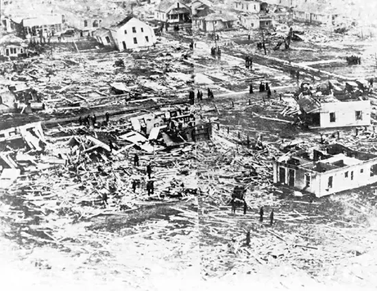
The Tri-State Tornado of March 18, 1925, holds the grim record as the deadliest tornado in US history. This catastrophic event began as a small funnel cloud in southeastern Missouri and rapidly transformed into a massive storm, traveling northeast at speeds of 60–70 miles per hour. It tore through Missouri, southern Illinois, and southwestern Indiana along a path exceeding 200 miles, marking it as one of the longest-traveled tornadoes on record.
With its immense size and power, this tornado devastated towns and cities, flinging cars into the air, uprooting railroad tracks, and demolishing buildings. In its wake, it left nearly 700 people dead, over 2,000 injured, 15,000 homes destroyed, and several communities severely damaged, if not completely obliterated. The financial cost of the destruction is estimated at around $2 billion in today’s currency.
Meteorologists classified the Tri-State Tornado as a Class F5 storm, the most damaging category with wind speeds exceeding 300 miles per hour. Its unprecedented path length and death toll made it the world’s deadliest tornado until it was surpassed by the 1989 Bangladesh tornado. The scale of the disaster catalyzed demands for improved tornado monitoring, leading to advancements in weather radar and satellite forecasting in the following decades.

