The 1906 San Francisco Earthquake remains one of the most significant seismic events in history, illustrating the dynamic nature of Earth’s tectonic plates. These plates, whose boundaries are hotbeds of geologic activity, manifest in various forms across the globe – from mountain-building collisions in the Himalayas to the earthquake and volcano chains in regions like the Andes and the US Pacific Northwest. In places like the western coast of North America, the parallel sliding of plates often results in earthquakes without volcanic activity.
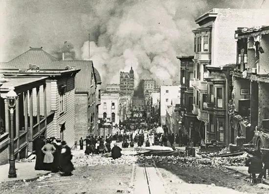
This phenomenon was starkly demonstrated on April 18, 1906, when a massive earthquake struck San Francisco and its surrounding areas. Lasting nearly 45 seconds, the quake caused extensive damage, especially to structures built on sedimentary grounds near San Francisco Bay, due to liquefaction. The immediate destruction and subsequent fires led to the loss of up to 3,000 lives.
Earthquakes are measured in terms of energy on a logarithmic scale, introduced by American seismologist Charles Richter in 1935. This scale categorizes earthquakes from small, often imperceptible quakes to those rare, catastrophic events with magnitudes above 8.0, which can cause extensive damage and loss of life. The San Francisco earthquake, although not the deadliest, was significant enough to propel advancements in building construction and urban planning. These developments have undoubtedly saved countless lives, as urban expansion and population growth continue on our constantly shifting crust.