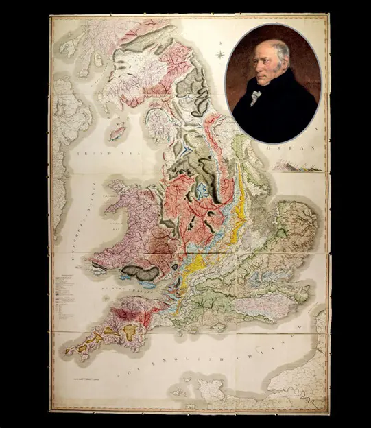
William Smith, often hailed as the father of English geology, revolutionized the field with his groundbreaking 1815 geologic map of Britain. This map set a new standard in geology, detailing a vast area with unprecedented precision, based on Smith’s extensive fieldwork as a surveyor in England, Wales, and Scotland.
Smith’s map skillfully employed color coding to distinguish various geologic units and pioneered the use of fossil similarities for correlating distant layers. Additionally, it included a geologic cross-section, offering a three-dimensional perspective of surface-exposed geology. Despite its remarkable accuracy and similarity to contemporary maps, Smith’s work initially faced neglect from the academic community due to his self-taught background.
Funding the publication himself, Smith endured financial hardships, including imprisonment for debt. However, his contributions were eventually recognized, and he earned acclaim as a pivotal figure in geology. His observational and mapping techniques have become integral to modern geologic maps, underscoring the enduring impact of his work.